
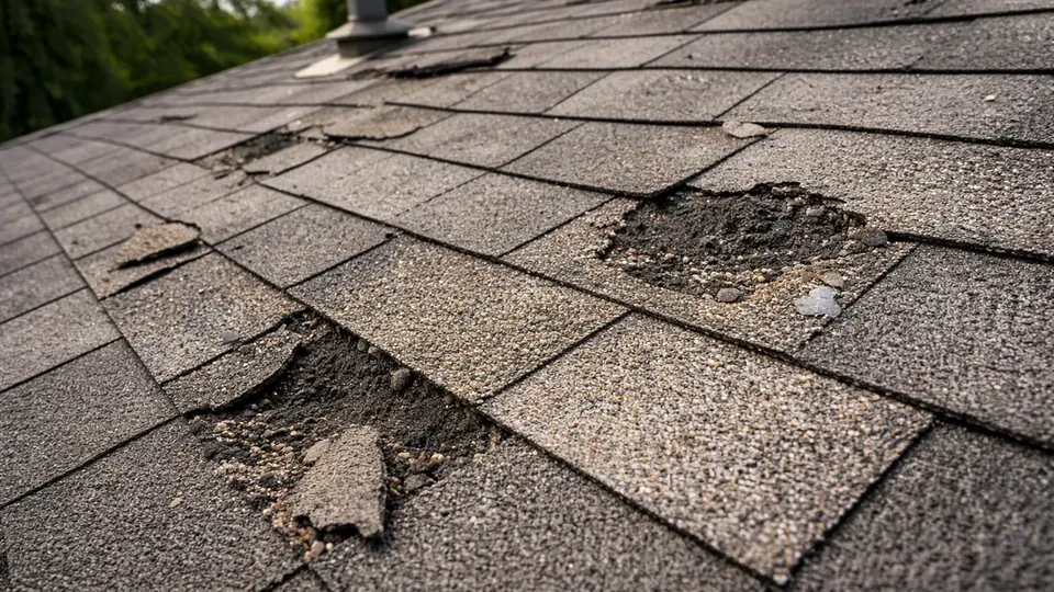
Filing a property insurance claim is easier when you understand the numbers, have your documents in order, and can show what the weather actually did on your date of loss. These free insurance claim tools are built for property owners in San Antonio, Bexar County, and the surrounding Greater San Antonio communities, where spring hail, downbursts, flash flooding, and the occasional hard freeze drive most property claims.
What each claim tool does
Insurance claim settlement calculator
The claim settlement calculator shows how replacement cost value (RCV), depreciation, your deductible, policy limits, and prior payments combine into an initial payment, recoverable depreciation, and out-of-pocket cost. It is a quick way to see why the first check is often smaller than the repair estimate, especially with a percentage wind/hail deductible.
Claim documentation checklist
The documentation checklist gives you a step-by-step list for hail, wind, fire, water, roof, and commercial property damage. Track your progress, add notes, and print or download it. Your entries stay in your browser.
Storm event lookup
The storm event lookup searches NOAA and National Weather Service reports near a San Antonio-area city or ZIP code, filtered by date, radius, and event type. It helps you find weather records that line up with your date of loss.
Live San Antonio weather
The live weather page shows current conditions at San Antonio International Airport, the 7-day forecast, and active NWS watches and warnings, along with storm preparation and post-storm tips.
Bexar County storm history
The storm history page lets you filter the official NOAA record for Bexar County, more than 1,500 events since the 1950s, by event type, date, location, hail size, and wind speed, with a timeline, map, and notable local storms such as the April 12, 2016 hailstorm.
Recent weather events
The recent weather events page collects preliminary National Weather Service Local Storm Reports for Bexar County and updates automatically, so you can see what was reported in the days after a storm, long before the verified NOAA record is published.
San Antonio building codes
The local building codes page explains the codes the City of San Antonio enforces, when re-roofing and repairs need a permit, and how code upgrades relate to ordinance or law coverage in your policy.
A simple way to use the tools together
- Confirm the storm. Use the storm lookup or recent weather events page to find reports near your city or ZIP code on your date of loss, and save a copy.
- Document the damage. Work through the checklist for your type of loss before cleanup or permanent repairs.
- Understand the numbers. When the insurer's estimate arrives, enter its figures in the calculator to see the ACV payment, recoverable depreciation, and what you may owe.
- Check code items. If the repair needs a permit, read the building codes page and compare the permitted scope with the insurer's estimate.
Use the tools, then get a second opinion
These tools are educational. They do not decide coverage, and a nearby storm report does not prove damage at a specific property. If your claim was denied, underpaid, or delayed, a licensed public adjuster can review your policy, documentation, and the insurer's estimate with you. Fees are disclosed in a written contract before any work begins; Texas law caps public adjuster compensation at 10% of the insurance settlement.
Frequently Asked Questions
Are these claim tools really free?
Yes. All of the tools are free to use, with no sign-up required. The calculator and checklist run in your browser, and nothing you enter in them is sent to us.
Can these tools tell me whether my claim is covered?
No. The tools are educational. They help you organize information and find weather records. Coverage depends on your policy terms and the facts of the loss. For a professional look at your situation, request a Free Claim Review.
Where does the weather and storm data come from?
Live conditions come from the National Weather Service station at San Antonio International Airport (KSAT). Forecasts, alerts, and recent storm reports come from the NWS Austin/San Antonio office in New Braunfels. Historical records come from the NOAA NCEI Storm Events Database for Bexar County. Each tool links to its original sources.
Do the storm tools cover cities outside Bexar County, like Boerne or New Braunfels?
The historical storm record on this site covers Bexar County. You can still search from a nearby city or ZIP code, and reports inside Bexar County within your radius will appear. For events recorded in Kendall, Comal, or Guadalupe County, search the NOAA Storm Events Database directly.